Start with a question, not just the globe
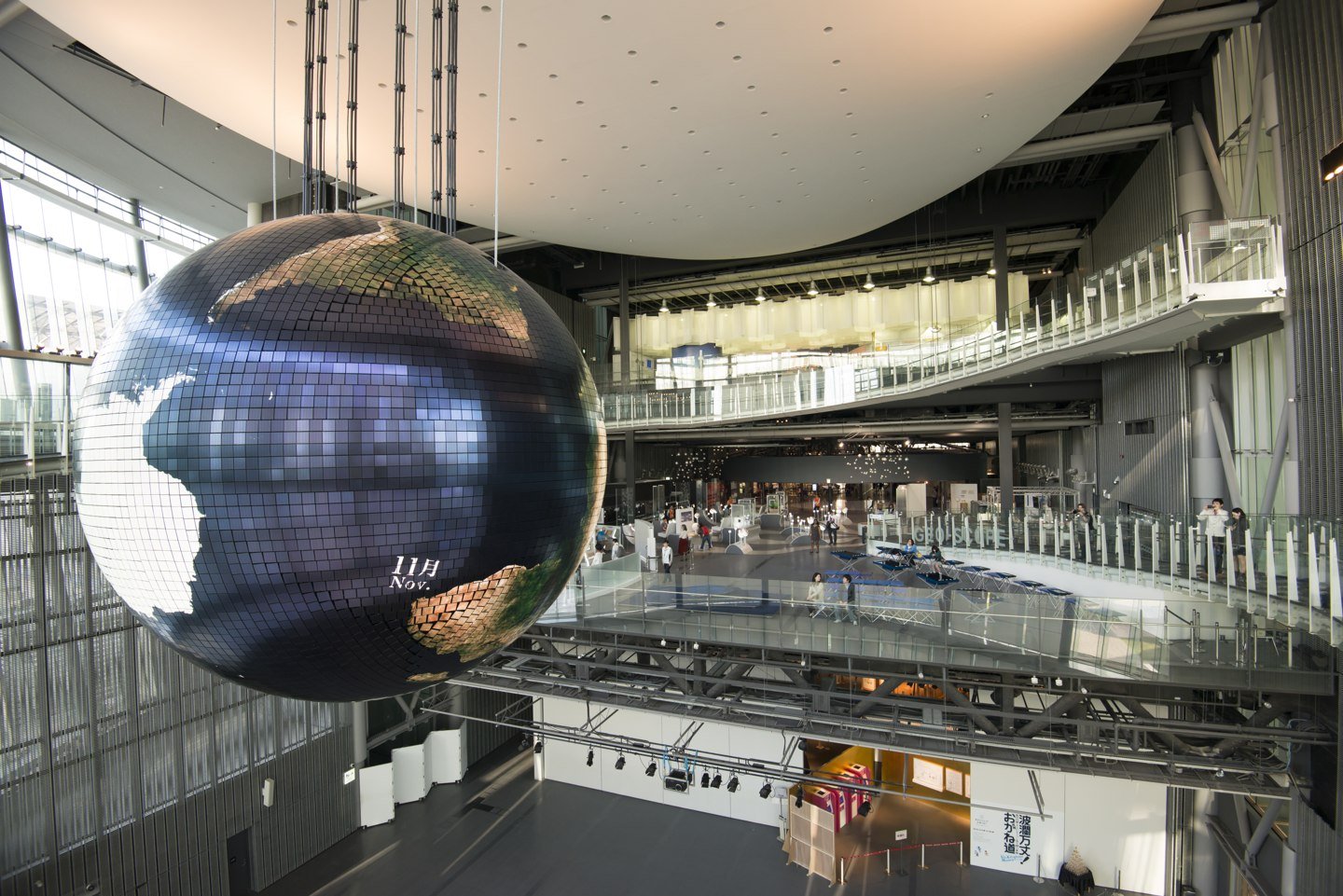
Miraikan’s Discover your Earth area turns planetary information into something people can examine together. Geo-Cosmos provides the large shared view; Geo-Scope gives visitors a way to explore datasets; Geo-Prism adds an augmented-reality layer. Their roles differ. One attracts your attention to the whole planet, another lets you investigate a specific pattern, and another helps compare information over the globe image.
Look for time as well as colour
The Geo-Cosmos guide describes cloud imagery built from weather-satellite photographs supplied daily, alongside background imagery showing seasonal changes in ice and vegetation. A changing image is therefore not automatically a live camera view. Ask which layer you are looking at and what period it represents. This is a useful habit anywhere a striking visualisation is used to communicate science.
Try a two-step investigation
The Geo-Scope guide lists subjects including migratory-bird routes and atmospheric aerosols. Pick one pattern, predict where it might be strongest, and then test your expectation against the display. Ask who supplied the data and whether it describes people, weather or living things. GIZUMO’s suggested exercise is to compare two explanations for a pattern before accepting the first story the colours seem to tell.
Plan around today’s programme
Use Miraikan’s exhibition, floor-plan and visitor pages to check which displays and activities are available for your date. The photograph here records the museum in 2013, so it is not a floor-plan reference for the present installation. This story is about reading scientific information; the museum’s current visitor information remains the place for admission, access and accessibility decisions.
Sources and next steps
Original English guide · Sources reviewed 6 October 2026. Operational details can change.
Exhibits and access can change. This collection does not offer product procurement, commercial specifications or live visitor information.

 Rail engineering